Travel Guide of Sukhumvit Road in Thailand by Influencers and Travelers
Sukhumvit Road, or Highway 3, is a major road in Thailand, and a major surface road of Bangkok and other cities. It follows a coastal route from Bangkok to Khlong Yai District, Trat border to Koh Kong, Cambodia
Download the Travel Map of Thailand on Google Maps here
Pictures and Stories of Sukhumvit Road from Influencers
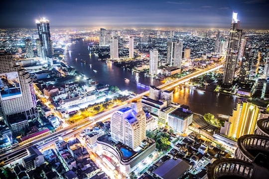
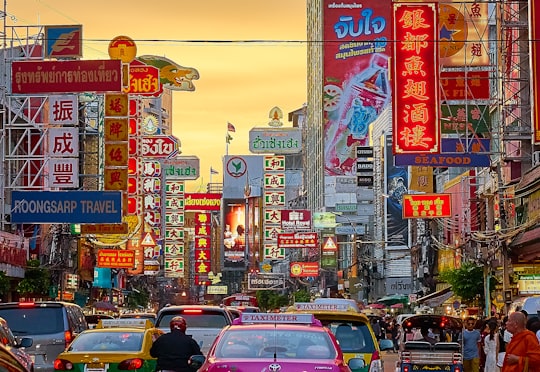
Picture from Andreas Brücker who have traveled to Sukhumvit Road
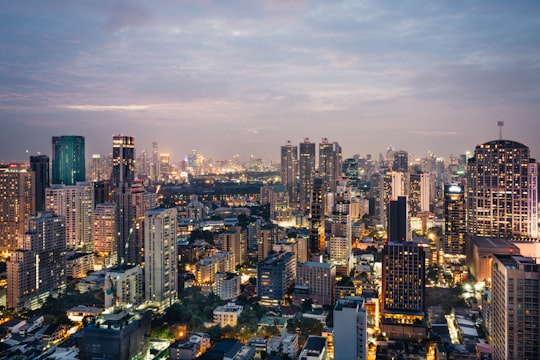
- Cityscape of Bangkok Downtown ...click to read more
- Experienced by @Andreas Brücker | ©Unsplash
Plan your trip in Sukhumvit Road with AI 🤖 🗺
Roadtrips.ai is a AI powered trip planner that you can use to generate a customized trip itinerary for any destination in Thailand in just one clickJust write your activities preferences, budget and number of days travelling and our artificial intelligence will do the rest for you
👉 Use the AI Trip Planner
The Best Things to Do and Visit around Sukhumvit Road
Disover the best Instagram Spots around Sukhumvit Road here
1 - Pratunam Market
Pratunam Market is one of Bangkok's major markets, and is Thailand's largest clothing market. The name Pratunam means 'water gate'.
View on Google Maps Book this experience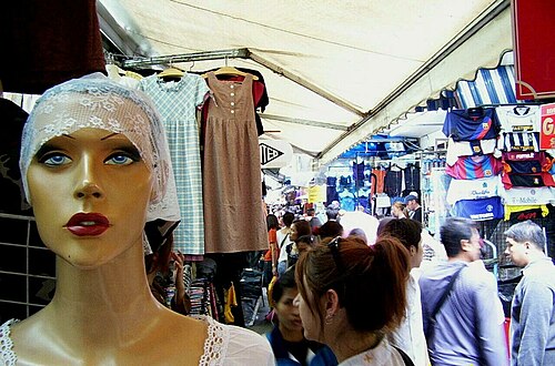
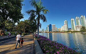
2 - Lumphini Park
Lumphini Park is a 360 rai park in Bangkok, Thailand. The park offers rare open public space, trees, and playgrounds in the Thai capital and contains an artificial lake where visitors can rent boats.
Learn more Book this experience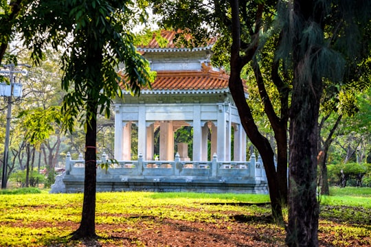

3 - Tours & Sightseeing | Day Trips from Bangkok
8 km away
Witness bustling waterways with a trip to the lively Damnoen Saduak floating market. Sail leisurely through the maze of vendors while enjoying the Thai countryside. Pause for a breather at a local riverside restaurant, where the mouthwatering aroma of Thai cuisine fills the air. Feast on a delicious lunch while admiring the scenic views of the shimmering Mae Klong River. The trip continues with a visit to the ancient Wat Bang Kung. This 500-year-old temple is renowned for its small chapel, fully encased within the roots of a banyan tree, dubbed Bot Prok Po. The tree stands as the temple's pillar, holding the sacred place together. Next, explore the intricate wooden carvings at the Wat Bang Kae Noi, built in 1868. The temple's walls narrate the life of Buddha. The adventure culminates at the Amphawa market. Here, engage in the local culture, stroll through the bustling market, and visit King Rama II Park before returning to Bangkok.
Learn more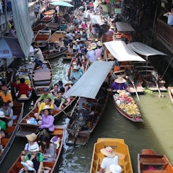
4 - Baiyoke Tower II
Baiyoke Tower II is an 88-storey, 309 m skyscraper hotel at 222 Ratchaprarop Road in the Ratchathewi District of Bangkok, Thailand. It is the third tallest building in the city, after MahaNakhon and Magnolias Waterfront Residences at ICONSIAM.
View on Google Maps Book this experience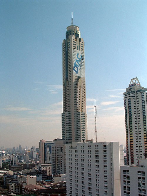
5 - Benjakitti Park
Benjakitti Park is a park in the Khlong Toei District of central Bangkok; situated next to the Queen Sirikit National Convention Center. It is close to Queen Sirikit National Convention Centre MRT Station, Sukhumvit MRT Station and Asok BTS Station. Benjakitti Park was developed from Tobacco pond area 200x800 meters, built by digging and reclamation. This park was part of the project replacement area from resolutions in government of Prime Minister Anand Panyarachun. Name “Benjakitti” was given by Queen Sirikit during the opening. Benjakitti Park has a landmark symbol called “Pathumthani” near the pond. It was opened in 2004 to honour the 72nd birthday of Queen Sirikit.
Learn more Book this experience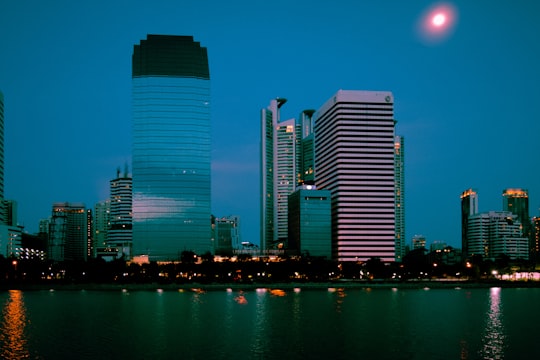
6 - Victory Monument
Victory Monument is a military monument in Bangkok, Thailand. The monument was erected in June 1941 to commemorate the Thai victory in the Franco-Thai War.
View on Google Maps Book this experience
7 - Lumphini
Lumphini MRT station is a Bangkok MRT station on the Blue Line. It is located on Rama IV Road, near Witthayu Road and Lumphini Park.
Learn more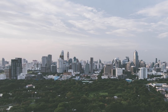
8 - Wat Khanikaphon
Wat Khanikaphon is a Thai private temple in the Maha Nikaya tradition of Buddhism, It is at Phlapphla Chai, Khwaeng Pom Prap, Pom Prap Sattru Phai District, Bangkok, in front of the Phlapphla Chai police station.
Learn more Book this experience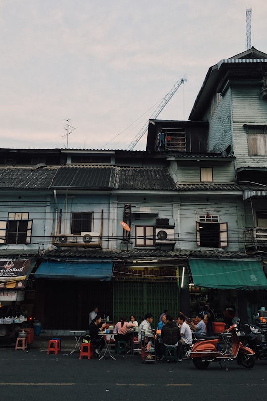

9 - Holy Rosary Church
The Holy Rosary Church, also known as Kalawar Church, is a Roman Catholic church in Bangkok. It is located in Samphanthawong District, on the eastern bank of the Chao Phraya River.
View on Google Maps Book this experience
10 - Thanon Phaya Thai
Phaya Thai is a district in central Bangkok, Thailand. Despite sharing a name, due to boundary changes, Phaya Thai Road and Phaya Thai BTS Station are in the adjoining Ratchathewi District.
Learn more
11 - Silom
Learn more
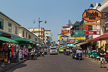
12 - Khaosan Road
6 km away
Khaosan Road or Khao San Road is a short street in central Bangkok, Thailand constructed in 1892 during the reign of Rama V. It is in the Bang Lamphu area of Phra Nakhon District about 1 kilometre north of the Grand Palace and Wat Phra Kaew.
Learn more Book this experience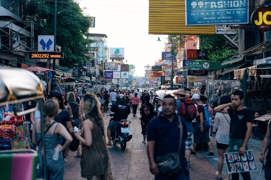
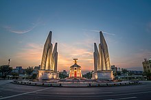
13 - Democracy Monument
6 km away
The Democracy Monument is a public monument in the city center of Bangkok, capital of Thailand. It occupies a traffic circle on the wide east-west Ratchadamnoen Avenue, at the intersection of Dinso Road.
Learn more Book this experience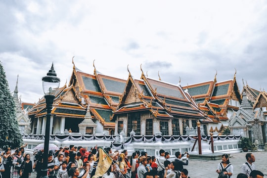
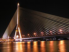
14 - Rama VIII Bridge
6 km away
The Rama VIII Bridge is a cable-stayed bridge crossing the Chao Phraya River in Bangkok, Thailand. It was built to alleviate traffic congestion on the nearby Phra Pinklao Bridge. Construction of the bridge took place from 1999 to 2002.
Learn more Book this experience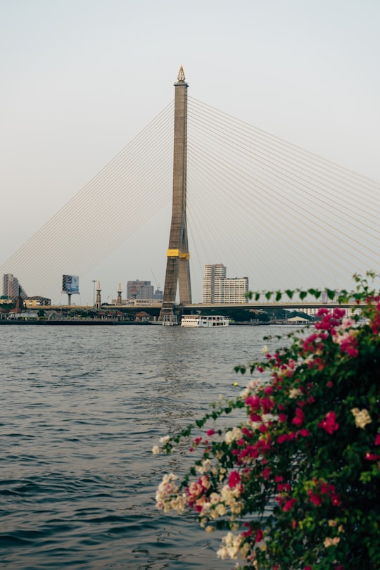
15 - Princess Mother Memorial Park
6 km away
The Princess Mother Memorial Park is a park in Bangkok, Thailand. It was established in 1993, and opened on January 21, 1997, by King Bhumibol Adulyadej, in remembrance of his mother, Srinagarindra, the Princess Mother.
View on Google Maps Book this experience
16 - Sirocco
6 km away
Learn more
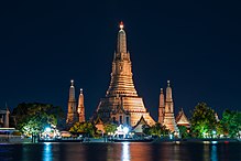
17 - Wat Arun
7 km away
Wat Arun Ratchawararam Ratchawaramahawihan or Wat Arun is a Buddhist temple in Bangkok Yai district of Bangkok, Thailand, on the Thonburi west bank of the Chao Phraya River.
Learn more Book this experience
18 - Chinatown
7 km away
Learn more
19 - Ratchadaphisek Road
8 km away
Ratchadaphisek Road is a major road in Bangkok, Thailand. Conceived in 1971 and opened in 1976, it connects earlier portions including Asok Montri, Wong Sawang and Charan Sanitwong Roads to form the city's inner ring road system.
View on Google Maps Book this experience
20 - Bangkok
8 km away
Bangkok is the capital and most populous city of Thailand. It is known in Thai as Krung Thep Maha Nakhon or simply Krung Thep. The city occupies 1,568.7 square kilometres in the Chao Phraya River delta in central Thailand and has a population of over eight million, 12.6 percent of the country's population.
Learn more
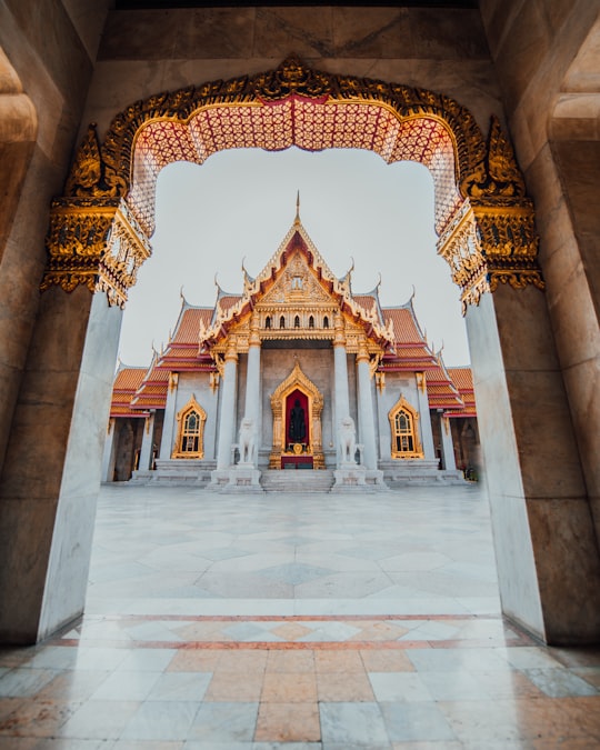
21 - Wat Benchamabophit the Marble Temple
8 km away
Learn more
Book Tours and Activities in Sukhumvit Road
Discover the best tours and activities around Sukhumvit Road, Thailand and book your travel experience today with our booking partners
Where to Stay near Sukhumvit Road
Discover the best hotels around Sukhumvit Road, Thailand and book your stay today with our booking partner booking.com
More Travel spots to explore around Sukhumvit Road
Click on the pictures to learn more about the places and to get directions
Discover more travel spots to explore around Sukhumvit Road
🌆 Skyline spotsTravel map of Sukhumvit Road
Explore popular touristic places around Sukhumvit Road
Download On Google Maps 🗺️📲